Local Maps and Information
Brill Parish & Neighbours

The above map is a screenshot from Ordnance Survey Election Maps.. To see more detail:
Go to Ordnance Survey Election Maps (website will open in a new tab)
Click on Boundary (in the left-hand menu), and select Civil Parishes or Communities.
Type Brill into the search box then select Brill, Buckingham - and voilà!
Working clockwise from due north, our neighbouring parishes are -
Ludgershall (website opens in new tab)
Wotton Underwood
Dorton
Chilton and Easington (website opens in new tab)
Oakley (website opens in new tab)
Boarstall
Piddington (website opens in new tab) in Cherwell District of Oxfordshire (website opens in new tab)
All our neighbours are in Buckinghamshire except Piddington. Links are for the relevant Parish Council websites. Wotton Underwood, Dorton and Boarstall have Parish Meetings rather than a Parish Council.
Map of Brill Village

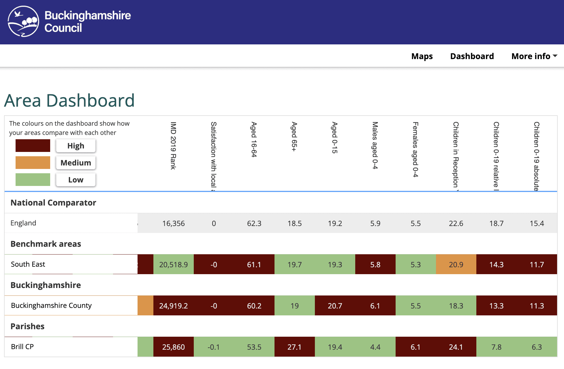
Brill in Numbers
The total population of Brill Civil Parish is 1,213 (all ages). The image below is a screenshot from Local Insight, a community mapping and reporting tool that gives instant access to neighbourhood level data. This chart breaks down the population of Brill into age groups and compares these proportions to Buckinghamshire and England as a whole. Visit this interactive resource on the Bucks Council website (opens in new tab) to find out more.